Global vs Local Positioning
When flying, positions are given using latitude and longitude — a global system measured from the equator (northings) and the prime meridian (eastings). Every point on Earth is referenced from these fixed origins, which is why aviation coordinates often look long and complex.
When walking, we don’t need global precision. Instead, we use the Ordnance Survey grid, which breaks the map into squares. Inside each square, your position is found by measuring:
- to the RIGHT → Eastings
- then UP → Northings
This means you always reference your location from the bottom‑left corner of the grid square you’re standing in, not from the equator or prime meridian. It’s a local fix, not a global one — faster, simpler, and perfect for navigation on foot.
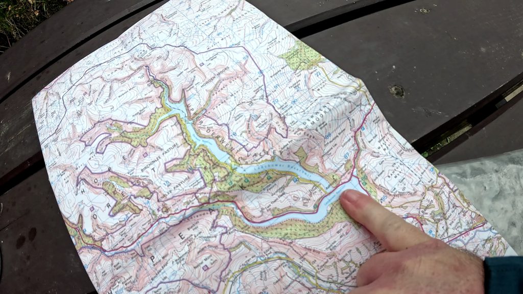
1. Start with the big grid – get the 4‑figure reference
Step 1 – Go RIGHT to find the easting
- Look along the top of the big map.
- Read the numbers: 12, 13, 14, 15.
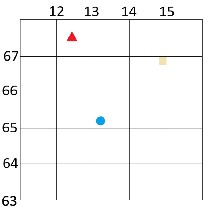
- The red triangle sits in the square to the right of 12 but before 13.
- So the easting is 12.
First two digits: 12
Step 2 – Go UP to find the northing
- Look down the left side of the big map.
- Read the numbers: 63, 64, 65, 66, 67.
- The red triangle sits in the square above 67 but below the next line up.
- So the northing is 67.
Next two digits: 67
So the 4‑figures of the grid reference we have so far are: 12_ , 67_
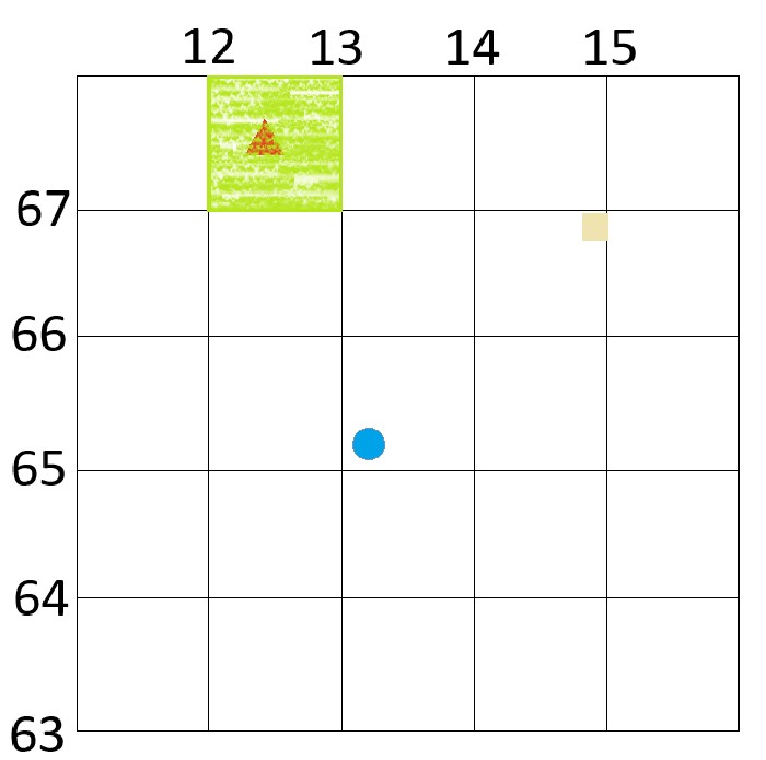
Zoom into the small 1–9 grid – turn it into 6 figures
Inside that 12–67 square, you have a smaller 1–9 grid to show tenths. (These are not visibly drawn on an OS map or it would be too cluttered.)
You now repeat the same idea, but inside the square.
Step 3 – Go RIGHT inside the small grid
- Look at the bottom of the small 1–9 grid.
- The numbers 1–9 run from left to right.
- Start at the left edge of the 12–67 square and count along until you reach the column with the red triangle.
- Suppose the triangle sits in column 4 of the small grid.
That makes the easting: 12 plus 4 tenths → 124
Step 4 – Go UP inside the small grid
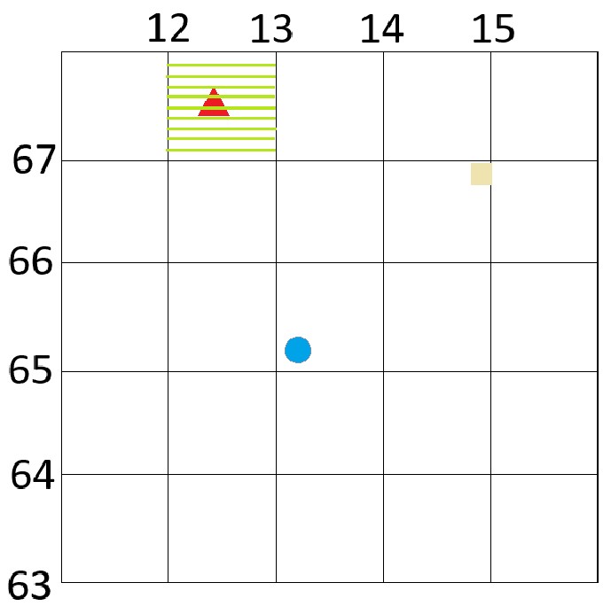
- Now look at the left side of the small 1–9 grid.
- The lines run 1–9 from bottom to top.
- Start at the bottom edge of the 12–67 square and count up until you reach the row with the red triangle.
- Suppose the triangle sits in row 5 of the small grid.
That makes the northing: 67 plus 5 tenths → 675
Put it together – the red triangle’s 6‑figure grid reference
Combine your three‑digit easting and three‑digit northing:
Red triangle grid reference: 124 675
In theory you can get even more accurate with 8 figure references and beyond, but in practice 6 figures is usually precise enough for route planning.
“Go RIGHT to get the Eastings, then go UP to get the Northings. First 4‑figure square → then 1–9 to make it 6 figures.” or “A-Long corridor and Up-stairs”
What would be the 6 figure references of the yellow square and the blue circle?
Mapzone | Ordnance Survey is a super, simple resource for further skills and introductory training.