
Explore every PeaksCompass route in one place. Each walk featured on our YouTube channel is pinned on this interactive map, making it easy to discover routes by location, terrain, or area of the Peak District. Select any pin to open the full route page, watch the episode, and access OS route cards, Knowledge (K) points, and on‑route decision moments.
Episode 19: Winster 9 Ladies Loop
PEAKS Focus on route: he old lead‑mining village of Winster, where narrow lanes and limestone cottages mark the edge of the White Peak. From here we climb through Clough Wood and break out onto the eastern flank of Stanton Moor — a plateau shaped by thousands of years of human activity.
Start Location: Winster
OS Route Link: Click to view
Start Location: Winster
OS Route Link: Click to view
Episode 18: Derwent Edge
PEAKS Focus on route: One of the great edges of the Dark Peak: Derwent Edge. Leaving the reservoir behind, we climb steadily until the moorland opens and the gritstone sculptures begin to appear. This episode focuses on the high ground — the tors, the legends, and the weather‑shaped stones that define this ridge.
Start Location: Fairholmes visitor centre Derwent Reservoir
OS Route Link: Click to view
Start Location: Fairholmes visitor centre Derwent Reservoir
OS Route Link: Click to view
Episode 17: Alport Castles
PEAKS Focus on route: Along the way we visit the iconic Tower at Alport Castles, drop into the sheltered valley of Alport Dale, cross the post‑glacial plateau of Alport Moor, and follow the historic lines of Devil’s Dike, Old Woman, and Doctor’s Gate back towards Lady Clough.
Start Location: Snake Woodlands (Birchen Clough)
OS Route Link: Click to view
Start Location: Snake Woodlands (Birchen Clough)
OS Route Link: Click to view
Episode 16: Bleaklow Loop
PEAKS Focus on route: A reflective high‑moorland circuit across Bleaklow, blending exposed terrain, real‑time route choices, and a respectful visit to the B‑29 crash site. A calm, decision‑focused walk through one of the Peak District’s most haunting and historic uplands.
Start Location: Torside Reservoir
OS Route Link: Click to view
Start Location: Torside Reservoir
OS Route Link: Click to view

Episode 15: Roaches & Luds Church Loop
PEAKS Focus on route: Narrow paths between boulders, wide stretches of open moor, and those quiet pockets of woodland around Luds Church that break the day into chapters.
Start Location: Roaches Roadside parking
OS Route Link: Click to view
Start Location: Roaches Roadside parking
OS Route Link: Click to view

Episode 14: Shining Tor & Cats Tor
PEAKS Focus on route: We explore the quieter side of outdoor leadership — pacing, reading the land, noticing subtle weather cues, and making small decisions that shape the day. From ridge visibility to woodland timing habits to navigating managed peat, this loop is full of moments that reward attention.
Start Location: Derbyshire Bridge
OS Route Link: Click to view
Start Location: Derbyshire Bridge
OS Route Link: Click to view
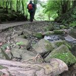
Episode 13: Tideswell and Cressbrook Dale
PEAKS Focus on route: Starting in Tideswell, the walk heads down Tideswell Dale and up to the Monsal Trail, before descending into Cressbrook Dale, following a mix of spring flowers, grassy paths, limestone tracks, and enclosed valley sections. Expect varied terrain, steady gradients, and a route that feels different at every stage.
Start Location: Tideswell
OS Route Link: Click to view
Start Location: Tideswell
OS Route Link: Click to view
Episode 12: Kinder Suprises
PEAKS Focus on route:Kinder’s rugged edges, picking our way through the terrain, reading the ground and making those small decisions that shape the day. It’s the kind of walk that reminds you why Kinder Scout holds such a special place in the Peak District — wild, unpredictable, and always worth the effort.
Start Location: Edale
OS Route Link: Click to view
Start Location: Edale
OS Route Link: Click to view

Episode 11: Chrome and Parkhouse Hill (The Dragons Back)
PEAKS Focus on route: We look at: Choosing your line on steep limestone ground Managing a bearing from the map, Reading the terrain ahead to stay efficient and safe, How the Dragon’s Back shapes your rhythm as you move across it.
Start Location: Longnor
OS Route Link: Click to view
Start Location: Longnor
OS Route Link: Click to view
Episode 10: Wolfscote & Dovedale
PEAKS Focus on route: Highlights The limestone entrance into Wolfscote Dale, with towering walls and echoing birdsong, Quiet riverbank sections where the Dove narrows and deepens, A steady climb to the high moor with wide, sweeping views, Natural scenario moments: route choices, terrain changes, and navigation decisions.
Start Location: Alstonefield
OS Route Link: Click to view
Start Location: Alstonefield
OS Route Link: Click to view
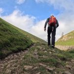
Episode 9: Castleton – Lords Seat
PEAKS Focus on route: Choosing the safest line on polished, uneven steps Spotting features that confirm your position before committing to a turn Recognising when wind or exposure is affecting your clarity Using simple tools — like the watch‑and‑sun method — to confirm direction Checking water levels mid‑route and adjusting your plan accordingly Taking short, purposeful breaks to reset your thinking and re‑orient
Start location: Castleton
OS Route link: Click to view
Start location: Castleton
OS Route link: Click to view
Episode 8: Win Hill Bamford
This episode explores how subtle decisions shape a journey: • When a group member pushes the early pace, how do you respond? • How tools like Naismith’s Rule help you read the shape of the day. • How to navigate woodland paths that don’t match the map. • When cloud builds earlier than forecast, what’s the smart adjustment? • How to balance enthusiasm and safety near exposed edges.
Start Location: Ladybower Reservoir
OS Route Link: Click to view
Start Location: Ladybower Reservoir
OS Route Link: Click to view
Episode 7: Lathkill Dale
PEAKS Focus on route: What your personal energy and pace feel like as the terrain shifts, How the environment changes when the valley narrows and sightlines reduce, How your accompaniment — real or imagined — influences rest points and route choices, What knowledge you draw on when moving from riverside calm to exposed hillside, How you maintain safety through small, continuous adjustments.
Start Location: Over Haddon
OS Route Link: Click to view
Start Location: Over Haddon
OS Route Link: Click to view
Episode 6: Stand Wood – Beeley
PEAKS Focus on route: Moorland navigation, aside Stand Wood, Estate paths and gentle elevation around the Beeley Loop. Real‑time decision points and route‑finding Calm narration designed for reflective outdoor learning.
Start Location: Robin Hood Pub
OS Route Link: Click to view
Start Location: Robin Hood Pub
OS Route Link: Click to view

Episode 5: Birchen Edge Loop
PEAKS Focus on route: A full loop of Birchen, Curbar, Froggatt Edge, filmed on location. Scenario‑based decision points to test your judgement, PEAKS pre‑walk principles in action, Real‑time observations on terrain, cold weather, and route choices.
Start Location: Robin Hood Pub
OS Route Link: Click to view
Start Location: Robin Hood Pub
OS Route Link: Click to view

Episode 4: Millstone Edge
PEAKS Focus on route: Principles for safe, confident walking in mixed terrain Real‑world examples of route‑finding and risk awareness A full loop that’s scenic, and perfect for building experience.
Start Location: Suprise View
OS Route Link: Click to view
Start Location: Suprise View
OS Route Link: Click to view
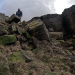
Episode 3: Stanage Edge Loop
PEAKS Focus on route: We look at how wind, visibility, terrain, and timing shape choices on the ground, and how small adjustments—pace, line, shelter, observation—build a safer, more confident day out.
Start Location: Upper Burbage Bridge
OS Route Link: Click to view
Start Location: Upper Burbage Bridge
OS Route Link: Click to view
Episode 2: Derwent and Howden Reservoirs
PEAKS Focus on route: This episode blends steady paths, good weather, and small decision points that shape the day. A gentle, reflective walk that invites you to slow down.
Start Location: Fairholmes visitor centre Derwent Reservoir
OS Route Link: Click to view
Start Location: Fairholmes visitor centre Derwent Reservoir
OS Route Link: Click to view
Episode 1: Redmires
PEAKS Focus on route: Reading the day as it unfolds Small checks that anchor your awareness Using wind, ground and terrain to guide choices A simple principle for confident movement.
Start Location: Redmires Reservoir
OS Route Link: Click to view
Start Location: Redmires Reservoir
OS Route Link: Click to view