Wind, Cold, and Conditions on the Tops (E)
How wind, temperature, and weather shape your day on the hill.
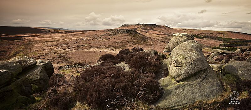
The Peak District occasionally throws extreme weather at you, but it is always expressive. Wind, cloud, temperature and ground conditions shift quietly, and each one nudges your decisions in small ways . This page gathers the key environmental cues that matter most when you’re out on the moors or moving between valleys and tops.
Wind Chill — Why Wind Changes Everything
Wind strips heat from the body far faster than still air. Even a gentle breeze can make a mild day feel sharp; a strong wind can turn a comfortable temperature into something draining.
- 10–15 mph: noticeable cooling, especially on exposed edges
- 20–30 mph: strong wind chill, harder to stay warm when stopped
- 30+ mph: balance affected, rapid heat loss, decision‑making slows
Wind chill matters because it affects how long you can pause, how quickly you cool after effort, and how much energy you burn staying warm.
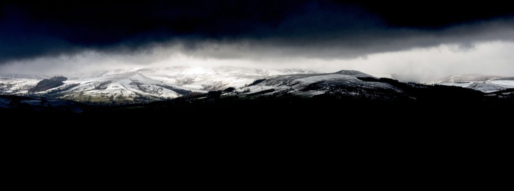
Valleys vs Tops — Why the Temperature Changes
The Peak District’s valleys and dales often feel sheltered, mild, and calm. The tops and moors are the opposite: exposed, windy, and several degrees colder.
Typical differences:
- 2–5°C colder on the tops
- Much stronger wind exposure
- Less shelter, more evaporative cooling
- Ground stays wetter for longer
This is why a walk that begins in a warm dale can feel completely different once you gain height.
Dressing for the Moors
Think in terms of managing heat early, not reacting late.
- Base layer: something that moves moisture away
- Mid layer: light fleece or thin insulated jacket
- Shell: windproof or waterproof depending on the day
- Hat & gloves: even in spring, wind on the tops can bite
- Spare warmth: a small duvet jacket for stops
| Too Cold | Too Hot |
|---|---|
| Early shivering | Heavy sweating |
| Cold fingers, fumbling with zips | Headache or feeling “foggy” |
| Slower decisions, irritability | Sluggishness, irritability |
| Stiff hands, difficulty with fine tasks | Nausea or dizziness |
| Feeling low‑energy or flat | Heat exhaustion risk |
| Cooling rapidly when you stop | Overheating on climbs |
| What to do: Add a layer early, eat something sugary, shorten pauses, keep moving steadily. | What to do: Remove a layer early, slow the pace, drink steadily, seek shade or shelter from wind. |
How Wind Speed Affects Temperature
Wind increases heat loss through convection. A rough guide:
- 10 mph wind: feels ~2°C colder
- 20 mph wind: feels ~5°C colder
- 30 mph wind: feels ~8–10°C colder
On the moors, where wind is rarely still, this is why a mild forecast can feel sharp.
Snow and hail form when cold air is lifted quickly — often by fronts, uplift over hills, or convective showers. On the tops, this happens more readily because the air is already colder and the wind pushes moisture upward.
Signs Snow Is Likely on the Hills
Walkers can spot snow conditions early by watching:
- Cloud base dropping
- Temperature falling with height
- Wind strengthening from the west or northwest
- Showers turning “grainy” or stinging
- Edges and walls collecting rime
- Ground beginning to crust underfoot
Snow on the hills doesn’t usually arrive without warning. Even before the first flakes fall, the landscape and the weather give you clues — and the forecast helps you understand how likely those clues are to turn into real snow.
What the Forecast Tells You
Peak District mountain weather on Met OfficeUK mountain forecasts highlight the ingredients that matter most:
Hazards — Met Office mountain forecasts flag snow, ice, and drifting risk.
Freezing level — when it drops below summit height, snow becomes possible.
Precipitation type — many UK sites show rain/sleet/snow layers or maps.
Wind direction — cold north or northwest flows favour hill snow.
Snow and hail tend to appear when:
- Cold air meets moisture — especially in showers driven by strong winds.
- Air is lifted quickly — hills force moist air upward, cooling it fast.
- Fronts pass through — warm fronts give wet snow; cold fronts give sharper bursts.
- Convective showers build — common in April and early winter.
- On the moors, exposed height makes these processes more efficient — so snow often arrives earlier and lingers longer than in the dales.
Why This Matters
The Environment pillar is about working with what the landscape is telling you right now, you cannot forecast everything in advance . Wind, cold, snow, and temperature shifts are part of the Peak District’s quiet expressiveness — and noticing them early helps you stay steady, safe, and ready for whatever the day becomes.