
Geology of the Peak District — A Quick Guide (2‑Minute Read)
The Peak District is split into two very different worlds: the Dark Peak and the White Peak. Their landscapes feel different because they are different — built from contrasting rocks that shape everything from the cliffs to the valleys, the rivers, and even the walking experience.
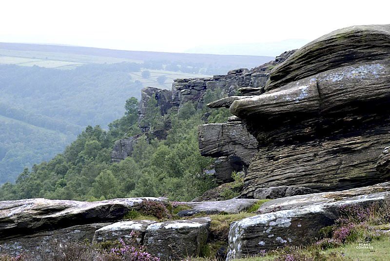
The Dark Peak — Gritstone Country
The Dark Peak is built from gritstone, a tough sandstone laid down in ancient river deltas around 320 million years ago. Gritstone is coarse, heavy, and stubborn. It weathers slowly, forming:
- high edges and plateaus
- rocky tors producing some of the best climbing in the world
- steep, broken slopes
- wide moorland tops
This is the landscape you see in the Alport Castles episode and in Derwent Edge — a world of rough textures, exposed ridges, and big skies.
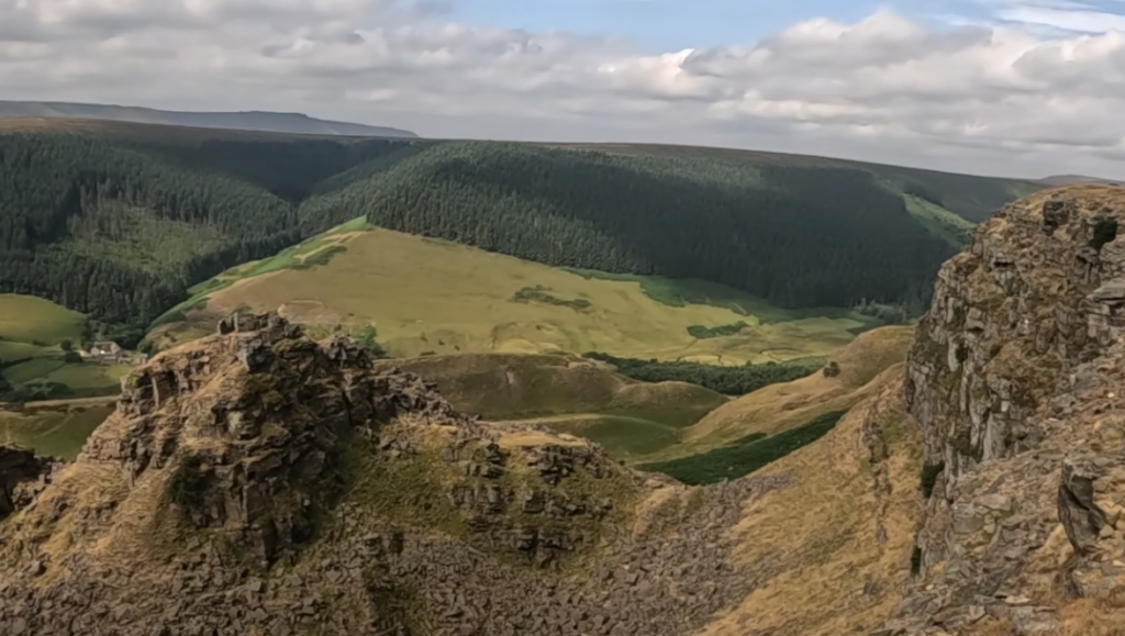
Alport Castles: A Dark Peak anomaly
Alport Castles is one of the most dramatic geological features in the Peak District. Here, heavy gritstone sits on top of softer shale. When the shale weakened, the gritstone above it collapsed in a massive landslip — the largest in Britain.
This created:
- The Tower — a freestanding block of gritstone
- a chaotic landscape of broken rock
- deep scars and tilted slabs
- a valley shaped by movement rather than erosion
It’s a rare place where you can see geology in motion — a reminder that even the toughest rock can shift when the foundations give way.
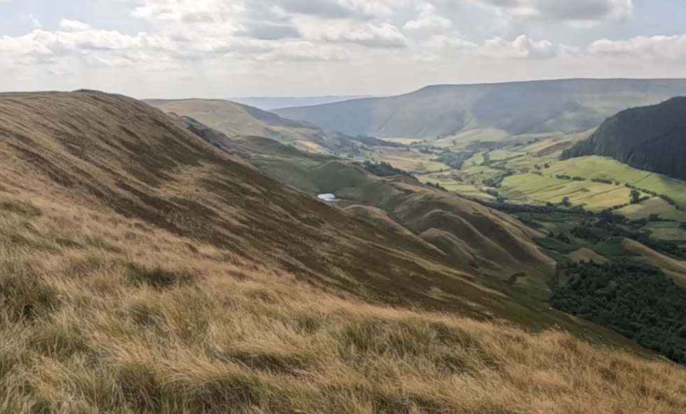
The White Peak — Limestone Country
The White Peak is built from limestone, formed in warm tropical seas long before the gritstone arrived. Limestone is softer and dissolves in rainwater, creating:
- deep dales
- smooth valley sides
- caves and underground rivers
- rounded hills and grassy slopes
This is the landscape of Dovedale episode — a gentler, greener world shaped by water rather than wind.
Dovedale: Limestone sculpted by rivers
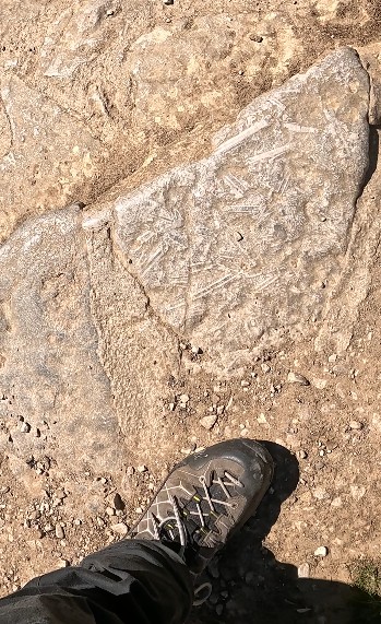
The River Dove cuts through the limestone, carving steep sides and forming pinnacles like Thorpe Cloud and Reynard’s Cave. Water is the sculptor here — dissolving, carving, and smoothing the valley over millions of years. If you look at some of the slabs on the path along the Dovedale route you can see small fossils.
Dragon’s Back — Where the Peaks Meet
Chrome Hill and Parkhouse Hill sit right on the boundary between the White Peak and the Dark Peak. These limestone ridges were once part of a coral reef system, later tilted by geological forces.
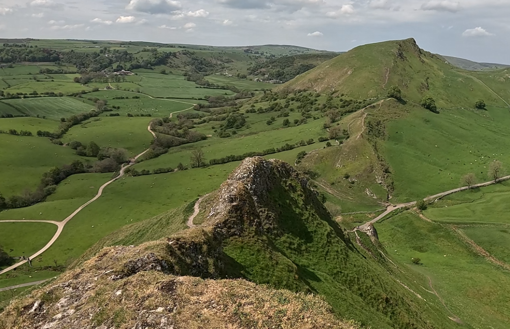
They show:
- the sharp, folded structure of limestone
- the contrast between smooth White Peak valleys and jagged reef edges
- how ancient seabeds became today’s walking ridges
Dragon’s Back (Chrome Hill) is a perfect example of how the Peak District’s geology isn’t just two halves — it’s a story of layers, collisions, and uplift.
Why This Matters for Walkers
Understanding the geology helps explain the feel of the walks: Here is a list of the current 17 walks found on the map page and a note to the terrain. (I will try to remember to update 🙂
Each landscape teaches you something different about the Peaks — and about how to move through them.
| Episode | Location | Geological Type | Landscape Character | Notes |
|---|---|---|---|---|
| 1. Redmires | Gritstone uplands near Stanage | Millstone Grit (sandstone) | Moorland, reservoirs, weathered edges | Classic Dark Peak gritstone plateau. with modern water management. |
| 2. Derwent & Howden | Upper Derwent Valley | Gritstone & Shale | High edges, tors, peat moor | Same formation as Alport — erosion and frost shaping tors. |
| 3. Stanage Edge Loop | Hathersage | Gritstone escarpment | Sheer cliffs, boulders, exposed ridges | Textbook gritstone edge — wind‑carved. |
| 4. Millstone Edge | Surprise View | Gritstone | Quarry faces, tors, woodland fringe | Shows human interaction with geology. |
| 5. Birchen–Curbar–Froggatt | Baslow | Gritstone | Layered grit edges, moorland top | Transitional zone between Dark and White Peak. |
| 6. Stand Wood–Beeley | Chatsworth area | Shale & sandstone mix | Estate slopes, wooded valleys | Softer rock, gentler terrain. |
| 7. Lathkill Dale | Over Haddon | Limestone | Deep dale, clear river, caves | Classic White Peak karst valley. |
| 8. Win Hill–Bamford | Ladybower | Gritstone cap over shale | Steep slopes, mixed woodland | Edge of Dark Peak. |
| 9. Castleton–Lords Seat | Castleton | Limestone & deposits | Caverns, ridges, mineral veins | White Peak heartland. |
| 10. Wolfscote & Dovedale | Alstonefield | Limestone | River‑cut valley, pinnacles | Water‑sculpted landscape. |
| 11. Chrome & Parkhouse Hill (Dragon’s Back) | Longnor | Limestone reef | Sharp ridges, folded strata | Ancient coral reef uplifted. |
| 12. Kinder Surprises | Edale | Gritstone plateau | Peat moor, tors, cloughs | Wild Dark Peak terrain. |
| 13. Tideswell & Cressbrook Dale | Tideswell | Limestone, volcanic | Grassy dales, caves, tunnels | White Peak valley system. Evidence of volcanic movement on Monsal trail |
| 14. Shining Tor & Cats Tor | Derbyshire Bridge | Gritstone ridge | High moor, panoramic views | Western edge of Dark Peak. Reservoirs. |
| 15. Roaches & Luds Church | Leek | Gritstone | Towering crags, deep clefts | Dramatic gritstone formations. |
| 16. Bleaklow Loop | Torside | Gritstone & peat | High moor, exposed plateau | Ancient erosion surface. |
| 17. Alport Castles | Snake Woodlands | Gritstone over shale | Landslip valley, tors | Britain’s largest landslip — gritstone collapse over shale. |
Explore These Geological Routes If you’d like to see some of these landscapes in motion, here are two Peaks Compass routes that bring the geology to life:
- Alport Castles Route — A walk through the UK’s largest landslip, showing the gritstone towers and the broken shale beneath. Watch the episode: click to view
- Dragon’s Back (Chrome Hill) Route — A classic Peak District limestone ridge formed from ancient reef structures, with dramatic folding and sharp edges. Watch the episode: click to view